Featured Map March 2022
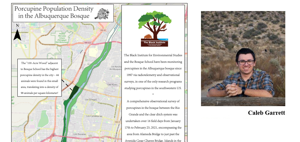
This map shows the estimated density of North American porcupine (Erethizon dorsatum) in the Albuquerque bosque.
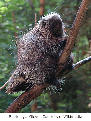 Many Burqueños are unaware that porcupines live in the bosque—porcupines’ penchant for spending daylight hours in the upper reaches of the cottonwood canopy can make them hard to observe. Students in the Wildlife Biology class at Bosque School have been monitoring porcupines on behalf of the Black Institute for Environmental Studies using radiotelemetry and observational surveys since 1997, leading to a wealth of data on this unusual creature (see the Bosque School website for more info). GES Master’s student Caleb Garret is currently working on a project to detect porcupines using thermal imaging. He is working with Bosque School students and the Black Institute to select a porcupine-rich study site to collect thermal imagery data, while the students continue to make observational surveys on the ground to provide a reference dataset.
In the process of picking a study site, Caleb collaborated with GES PhD student Rowan Converse to map the data that Bosque School students collected in early 2021. Both Caleb and Rowan are associated with UNM’s Center for the Advancement of Spatial Informatics, Research, and Education (ASPIRE). ASPIRE embarked on this collaboration because we hope to build connections to provide education and research support about urban wildlife in the Albuquerque community. Bosque School was interested in having a new approach to their porcupine research and exposing the Wildlife Biology students to geospatial technologies. Rowan’s history with Bosque School goes way back—she is an alumna, and after college she worked with the Bosque Ecosystem Monitoring Program (another long-running environmental project at the school) for several years— so it was fun for her to work with Bosque students on the porcupine project.
ASPIRE is an interdisciplinary research collaborative at UNM focused on developing cutting edge geographic information technologies and methodologies through the collection of valuable data on the lived environments of New Mexico and beyond. You can find more detailed information on our projects as well as resources we’ve developed for public use on geospatial technologies and methods at our website: https://aspire.unm.edu/
