Featured Map May 2022
This featured map is one of many maps students produced in Professor Maria Lane’s Critical Cartography class. Students worked together to create Story Maps that followed El Camino Real de Tierra Adentro, a historic network of trails. These trails stretch from modern-day Mexico City to Ohkay Owingeh, New Mexico, passing through what is now Albuquerque on the way. Students worked with community partners to improve awareness of and access to the Camino Real corridor through Bernalillo County. They used maps, images, audio, video, and original text to help viewers explore connections between our modern neighborhoods and the Indigenous, Spanish, and Anglo histories of movement and agriculture in the same places. Students diligently research to find historic maps such as the one posted above.
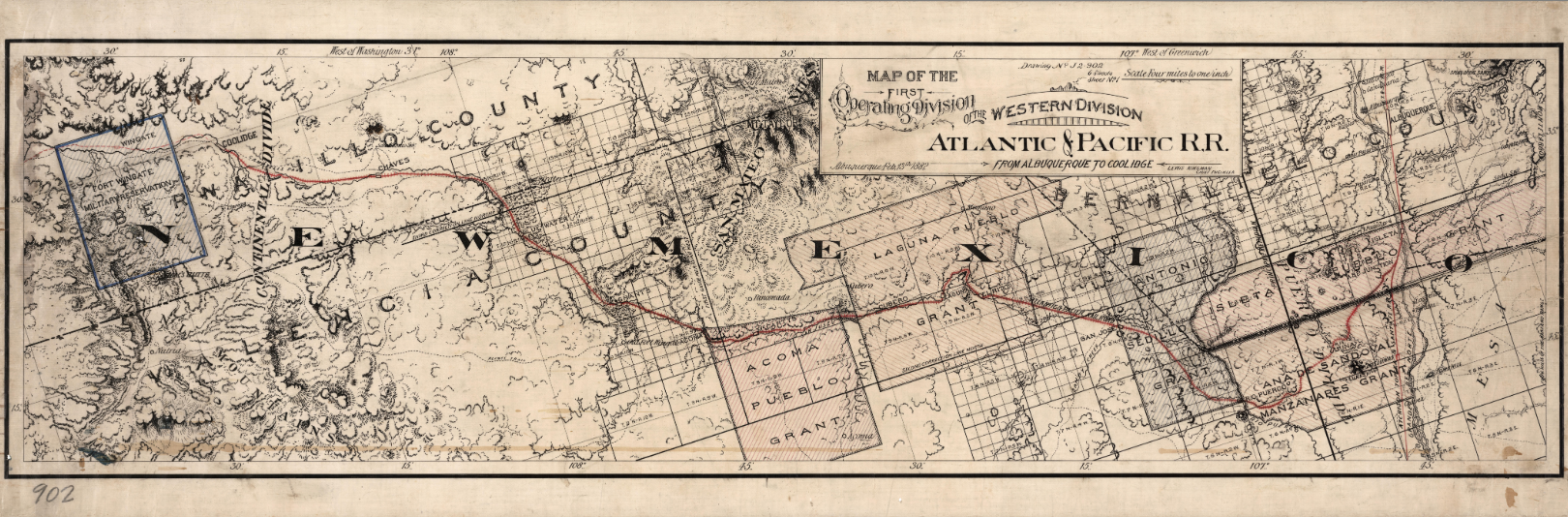
This is an 1882 map of the Atlantic and Pacific Railroad that intersected the Atchison, Topeka and Santa Fe Railroad along El Camino Real de Tierra Adentro (source: David Rumsey Historical Map Collection, Library of Congress). This map along with the rest of the story map was published on the the National Park Service website of National Trails. See the full story map.
Congratulations and great job to the following students: Desiree Loggins, Michael Gurule, Camilio Calabaza, Marissa Heller, Ramona Malczynski, Sarigai Sarigai, Will Mehle, Kendyl Key, Rowan Converse and Shannon Pepper
